
When you think of the Mayan civilization, your mind might drift to the grandiose temples, ancient rituals, and intricate art that encapsulates this remarkable culture. Nestled in the heart of Central America, the Mayan ruins of Guatemala present an extraordinary tapestry woven with stories of a civilization that flourished for centuries. This article serves as a portal to explore these hauntingly beautiful ruins, equipped with an interactive map that offers a modern twist to your journey through history.
The allure of Guatemala’s Mayan ruins cannot be overstated. The country, often referred to as the cradle of Maya civilization, is home to an astonishing array of archaeological sites that speak to the ingenuity and complexity of its ancient inhabitants. These remnants of a sophisticated society arise from the misty jungles, inviting explorers and history enthusiasts alike to delve into their ornate past.
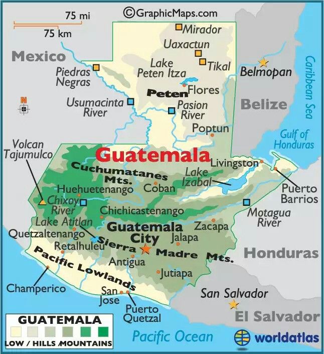
To embark on this journey, let’s dive into the interactive map that can guide you through the ruins, highlighting each monumental site’s significance and its cultural heritage. With just a click, you may be transported to the likes of Tikal, Quiriguá, and Yaxhá—each location possessing its unique narrative and splendor.
Tikal: The Majestic City of the Sky
First on our exploration is Tikal, the most celebrated of all Mayan cities. Strategically nestled within the lush rainforests of northern Guatemala, Tikal was not only a political and economic hub but also a spiritual center that reached its zenith between 200 and 900 AD. The site boasts towering pyramids, such as Temple I and Temple II, which seem to pierce the sky. Standing before these structures, one can almost feel the whispers of the ancients echoing through the canopy.
Utilizing the interactive map, visitors can navigate through Tikal’s expansive ruins, discovering the Great Plaza and its plethora of stelae—stone monuments that commemorate important events and rulers. As you wander, pay heed to the rich biodiversity; monkeys and exotic birds share their habitat with these ancient stones, offering a rare glimpse of coexistence between nature and history.
Quiriguá: A Monumental Cultural Epicenter
Next, set the map toward Quiriguá, a rather compact archaeological site that packs an impressive punch. Situated in the Motagua Valley, this site is renowned for its intricately carved stelae that narrate tales of Maya kings and their conquests. Interestingly, Quiriguá was once a vassal of the greater Copán and later flourished in its own right, showcasing the fluid nature of political alliances among city-states.
Your virtual exploration through the interactive map reveals the grand stelae, including the astonishing Stela E, which stands as one of the tallest in the Mayan world. As you absorb the artistry etched into the stone, ponder the stories these figures embody—not merely the regalia and power of the kings, but their connection to the cosmos and the divine.
Yaxhá: The Enigmatic Lakeside City
A lesser-known treasure yet equally intriguing is Yaxhá, situated beside two picturesque lakes. This site offers a serene atmosphere where visitors can reflect upon the historical significance of the ruins while surrounded by natural beauty. Divided into several distinct complexes, Yaxhá was once a formidable city-state that thrived during the Late Classic period.
Through the map, you can explore Yaxhá’s unique layout, which includes spectacular temples and plazas not as crowded as those of Tikal. This tranquility allows for an intimate connection to the site, as you imagine the vibrant life that once thrived here. Yaxhá also represents one of the few ruins where an observatory was located, allowing scholars of the time to make celestial observations that were integral to their agricultural practices and religious ceremonies.
Exploring & Understanding Beyond the Ruins
As you traverse these ancient landscapes via the interactive map, the experience transcends mere sightseeing. Each click unveils an opportunity to engage with the past, to appreciate the profound knowledge the Mayans possessed about astronomy, mathematics, and agriculture. Moreover, these sites became focal points for understanding the intricate socio-political dynamics among the Maya, providing invaluable lessons in resilience and adaptability.
While physical visits to the ruins offer unparalleled experiences, the interactive map bridges the gap for those unable to embark on such journeys. It allows for an exploration that is not confined by geographical limitations. Here, one can glean insights into the ruins’ architecture, timelines, and even the flora and fauna surrounding these areas—all the while sparking curiosity about the mysteries that remain unsolved. How did the Maya comprehend the celestial bodies, and what led to the eventual decline of their great cities?
A Call to Action
In conclusion, the Mayan ruins of Guatemala beckon explorers to immerse themselves in a history that is rich and layered. Armed with an interactive map, you can traverse the remnants of this magnificent civilization, embarking on a journey that promises to shift your perspective on time, achievement, and the interconnectedness of nature and human endeavor.
Now, whether you are planning a physical expedition or engaging with the interactive map from the comfort of your home, let your curiosity guide you. Each archaeological site is a doorway to the past, waiting for you to step through and marvel at the echoes of history that continue to resonate in the present. The journey from a mere tourist to a thoughtful explorer of the Mayan ruins of Guatemala awaits.
